Showing posts with label Hexographer. Show all posts

Saturday, April 4, 2020

Middle-Southlands Map

Seems I am on a map-making tear rather than a campaign-development tear.

Reading through the OD&D boxed set and the B/X books of late, combined with several recent requests for the Hexographer file for my old Southands map, caused me to return to that map and see what more I could do with it.

So I thought to myself, "Self, what would 13-year old you do with this material and Hexographer?"

And so I present to you a map of "Middle-Southland," combining the Outdoor Survival map with OD&D, B/X, and a few other choice bits of D&D, with Middle-earth (and a dash of Shannara, I suppose), as I probably would have drawn back when I first read through Lord of the Rings and the Silmarillion.

Grab a copy of the map, pull out your OD&D box or B/X (or Labyrinth Lord) books, and get together online with your buddies, and let your 13-year old selves do some exploration...

Click to embiggen

If you want a larger PNG of the map, or a copy of the Hexographer file, just email me at jamesmishler@gmail.com

Stay Home! Stay Safe!

Enjoy!

Saturday, March 23, 2019

[Known Realms] Map of the Northlands for Dungeon Crawl Classics

Back in early 2018 I started working on a campaign for the Known Realms of Aereth, the campaign setting for the original 3E Dungeon Crawl Classics line. Being me, of course, the first thing I had to do was set up a Hexographer map of the Northlands; nine maps, each hex 25 miles across, covering pretty much the entire Northlands except for the northernmost wastelands and Punjar (which really is part of the Lostlands, anyway).
 
As is normal with my life, other things got in the way of completion, and I moved on to other campaigns. However, the maps have still been sitting there, not complete but mostly complete, and now and again I've been thinking of them and what I can do with them.
 
Would anyone be interested in seeing these maps completed? Along with a Wilderlands-style run-down of major cities, towns, castles, citadels, ruins, islands, and lairs? Each of the nine maps would be sold separately with a gazetteer (under license from Goodman Games, of course).
 
Below is a small, stitched-together version of the first draft of the nine maps. Each of the nine has since been worked over more, with more details and corrections between the stitching areas, so this is merely a rough draft.
 
 
Let me know what you think...

Click to embiggen


Friday, April 14, 2017

[JMG] The Incompleat Realmscrawl

So last year I tried to jump into the 5E market on the Dungeon Masters Guild, with some hex-based mapping of the Forgotten Realms called Realmscrawl (also, alternate version of FR based on some old campaign stuff). Sales went nowhere, for various reasons.
 
I had already done a lot of work on the rest of the Realmscrawl maps, and have decided to release the Incompleat Realmscrawl maps into the wild. The linked product includes all eight of the remaining Realmscrawl map Hexographer files, as well as small PNGs of each region, and one very small scale "mega-map" of all nine regions of the Eastern Heartlands altogether.
 
As mentioned, it is incomplete... none of the maps have any names on them, most got to the placement of locations stage, and Map #9 is only in primitive layout stage. But if you are into FR, or just need a blank sandbox or eight, this is for you, and at the right price... if you have Hexographer, of course...
 
The Incompleat Realmscrawl
 
 
Herein you will find the remaining eight maps of the Realmscrawl line, which never quite took off.

The initial release, Realmscrawl Campaign Map #5: Tilverton, never sold enough for me to further develop the line.
 
However, I still have my initial work done on the rest of the maps; here they are, incomplete, ready to be further developed for your own campaign using Hexographer.
 
Included are the Hexographer files for Maps 1 to 4 and 6 to 9.
 
Maps 1 to 4 and 6 to 8 are essentially complete, save for names. Map 9 is in a rather more primitive condition, but the general outline is all there.
 
Also included are small maps of each of the eight regions, in PNG format, as well as one map of all nine regions stitched together in a primitive fashion (made with slightly older versions of the maps included herein).
 
PAY WHAT YOU WANT
 

Sunday, February 19, 2017

[Review] Project Oasis by Joseph Bloch -- 5 out of 5 Stars

Project Oasis, written by Joseph Bloch (Adventures Dark and Deep, Castle of the Mad Archmage) and self-published through BRW Games, is a 36-page PDF campaign supplement for Mutant Future and Apes Victorious, both being post-apocalypse (PA) games by Goblinoid Games.

Set 1000 years after the Devastation, it is a “kitchen-sink” style setting, containing all the themes and ideas from a wide spectrum of early PA literature, film, and television, focusing on the materials developed in the 1970s. Planet of the Apes, Ark II, Omega Man, Logan’s Run, Twilight Zone, Mad Max – it’s all here in a fantastic melting pot that gives you an entire continent of possible adventure.
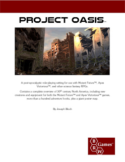
 
 
The two-page introductory section explains the basics of the world and how it came to be; speaks of technology and geography; and gives some basic guidelines for the kinds of campaigns the setting is designed for (very different from many modern PA settings, due to the strong influence of the middle-era of the PA genre). Details are brief, but give a game master more than enough material to get started.
 
We then get to the meat of the booklet, the 22-page gazetteer. This covers every major power in the PA setting, a mix of stone-age savagery to high-tech insanity. Virtually every kind of PA trope is covered in this, with lots of opportunities for a game master to start a campaign in exactly the kind of setting he wants, then move the adventure on to other regions. There are ape realms, human-friendly, human-neutral, and human-enslaving; there are high-tech mutant realms hidden under wastelands, low-tech mutant wilds, human-mutant cooperatives, and mutant-power domains; there are hidden high-tech cities of wonder where the people are dedicated to recovering what was lost, high-tech cities of wonder where the people are kept in dystopian decadence, and there are low-tech kingdoms dedicated to keeping things exactly the way they never really were in chivalrous glory. And that’s just for starters!
 
I’m being a bit nebulous here, as I believe that it would give you, the reader, far greater joy to discover the world of Project Oasis on your own, rather than have me list off the regions chapter and verse.
 
Two things I will discuss are "Project Oasis" itself and the inclusion of adventure hooks with each region. First, Project Oasis is not simply the name of the book, it is also a major faction in the PA world. Project Oasis is a very high technology organization, operating from a secret base, that seeks to bring the world back from savagery (echoes of Ark II, Earth II, and Planet Earth); to this end, they send out teams of adventuring types to help uplift goodly domains and bring down or stall villainous ones. This provides an excellent hook on which the game master can hang her campaign, as it enables player characters to travel all over the continent (and beyond) with as much technological support as the game master wishes them to have at the time. Second, each of the region entries has three adventure hooks included, at least one of which deals with Project Oasis and how it, and its representatives, might interact with the peoples and powers of the region. So the book itself, as mentioned in the introduction, really gears play toward a Project Oasis-based campaign, though myriad other options are readily available.
 
The volume finishes with three short appendices, two dedicated to new monsters (one for Mutant Future, the other for Apes Victorious), and the other a listing of inspirational material. The new monster sections include everything mentioned in the work that was not otherwise found in Mutant Future and/or Apes Victorious, each section covering the same monsters. The list of inspirational material provides most of the books, films, and television shows you would need to read or watch to better understand the setting. Personally, if you have no experience with the middle-era PA genre, I’d watch Ark II, the Planet of the Apes movies and television series, and the Logan’s Run movie and television series; these give you a complete overview of the relevant material and, most especially, style of the genre.
 
Finally, there is the continental map. Created using Hexographer, it shows the relation between the new geography of the continent and all the various regions, including cities, major towns, ruins, and other notable locations. The only problem with it is that I have not been able to find a scale for the map anywhere on the map or in the book… I think it is 30 or 40 miles per hex? [NOTE: Confirmed from Joseph that the scale is in fact 30 miles per hex.]
 
Click to embiggen; this is a small and shrunken snippet of a full continental map!
 
The upshot of the review is that this is the best PA campaign setting on the market today, if you are into the middle-era PA genre. If you aren’t, well, get on the bandwagon! The PA middle-genre provides you with all the action, adventure, seriousness, and wild and wacky wahoo you could ever want out of a PA setting, and this book distills it all down for you. Project Oasis plus Mutant Future and Apes Victorious can provide literally years of PA adventures. With Project Oasis Joseph Bloch has presented the PA gamer community with a PA campaign “Greyhawk Gazetteer” upon which to build and develop their own campaigns.
 
Project Oasis is a book I wish that I had written. And really, I can’t give it better kudos than that.
 
Five out of Five Stars
 
Project Oasis
by Joseph Bloch
Published by BRW Games
36-page PDF with PNG Continental Map
$9.95
 
Note: I purchased Project Oasis with my own money. I have not been offered anything in return for a review. The links above go through the Affiliate Program at OBS, so if you buy something after clicking through, I get a taste of the action. Hope all the cyber-cops are happy with this disclaimer.

Sunday, August 18, 2013

[Gondwane] Map of Lin Carter's Northern YamaYamaLand

One of my favorite series by Lin Carter is his exploration of the Dying Earth genre, the Gondwane Epic featuring the tales of Ganelon Silvermane. Gary thought enough of them to include them in Appendix N. They read like the adventures of a gaming group, and the world seems designed for a science-fantasy campaign, with its odd mix of magic and technology.

Being on a map-making binge, I was overjoyed when I discovered that I had thrown an early, hand-drawn study of Northern YamaYamaLand, the main region featured in the adventures of the first two books, in my box of papers and stuff before heading out for Virginia. So over the last couple days I've been futzing around with another Hexographer map. 

The general form of the setting is as per the book; I've added in additional details such as villages, more ruins, lairs, and the like, and filled in a few holes in the northeastern and northwestern corners of the map. The most unusual features, for the uninitiated, are those found in Dwarfland. These are not Tolkien dwarves; they are the Death Dwarfs, a form of Unlife, inimical to the more common like of Gondwane. They are more like poisonous goblins than dwarves, and the life and lands they rule are similarly unpleasant...

The scale is arbitrarily set to five miles per. It could as readily be six or 10, as during the story the distances traveled seem not to jibe with one another, essentially traveling at the speed of plot...

Anyhoo, one of these days I might get around to trying a Mutants & Mazes (Labyrinth Lord/Mutant Future) or Labyrinth Critical campaign in the setting... that would be sweet. As usual, if you want a bigger map or the original Hexographer files, just let me know.

Click to embiggen

Tuesday, August 6, 2013

[Antares] Mapping Imirrhos

A while back Jeff Rients posted about having fun with Imirrhos, the planet otherwise known as Antares IX from the classic TSR minigame, Revolt on Antares. Recently on Google+ he posted more on his developing science-fantasy campaign. And as I've been casting about for random cool stuff to doodle with using Hexographer, I figured, what the hell... so here are three maps of Imirrhos. As the planet is about the size of Mercury, I've set each hex at 72 miles, easily divisible into 24-mile hexes, and thus into 8-mile hexes. YMMV, literally...

As usual, click to embiggen; and if anyone wants the original Hexographer maps or larger PNG files, let me know...

Imirrhos Plain Geographical

Imirrhos Gameboard Reproduction
(With added numbers, because numbers are cool)

Imirrhos Rients Campaign


Friday, July 5, 2013

[Gamma World/Mutant Future] New Map of Central Gamma World

So as is pretty obvious, I've been in a slump lately, creatively speaking. Other than that Outdoor Survival map I worked up two months ago, it's been... a while, since I've done anything. I'm trying to get the mind working again by futzing around with Hexographer once again. This time I've put together a Gamma World/Mutant Future/Mutants & Mazes map.

The map is loosely based on the second version of the Gamma World map included with the 2nd and 3rd edition of that game. I took the map, tilted it 30 degrees ("The war blew the world off its axis!"), and cut out the central lands to give me a base for a 30 hex tall by 50 hex wide region (with wide, wide interpretation). Then I just added bits here and there, slapped on some names, and Bob's your mutant uncle!

I have no plans on doing anything more with this map, so feel free to run with it if you want for your own campaigns. The names provided are either names of the ruined cities or of the regions; there are no names for any of the modern towns or tribal locations. Much of the West is nameless, as the tribes there are few and far between. The scale, by the way, is 30 miles per hex (more or less).

If you want the original Hexographer file or a larger PNG, just email me...

As usual, click to embiggen...

Thursday, May 2, 2013

[Southland] New Version of Outdoor Survival Map

When I need to get my game on, but can't really concentrate on writing and can't get together with anyone to play, I draw maps. Call it a kind of occupational therapy, if you will.

Once upon a time I did that by hand... but now I mostly use Hexographer. Going through  my "Campaign Setting" folders, I stumbled upon the work done on Southland, the post-Blackmoor setting Dave Arneson used after his group essentially trashed the original campaign. The setting used Avalon Hill Game Company's Outdoor Survival map, as was mentioned in The Underworld & Wilderness Adventures booklet in OD&D. Robert Conley created a fine Judges Guild style version of the map long ago

I decided I wanted to play around with the map, maybe make a few variants, so I put together a base, "original" version of the map. My version does not include the "Encounter Areas" that Rob's does, but is otherwise pretty close. Later variants will develop the region more, and include different climate versions.

If you want a larger PNG or the original Hexographer file, drop me an e-mail...

Click to embiggen...

Saturday, March 23, 2013

The Mighty Land of Vanth

Well, we are getting settled in here in Virginia Beach. No luck thus far with finding a job, but at least I have my first interview coming up next week. One interview in three weeks is much better than one interview in six months by any count! And ideally, I'll get a chance to play some Labyrinth Lord tomorrow, God willing and the creek don't rise!

What with settling in and looking around and job hunting, I really haven't had the energy to work on anything for the Olden Lands. That requires craftsmanship... if I'm selling it, I want it to be my best stuff, not just something I slapped together. But the creative urge is strong, and so I've been screwing around with Hexographer, 'cause I love drawing maps.

I decided to put together the map of my version of Vanth, the world from Encounter Critical, which I intend to use with a Labyrinth Critical campaign, someday. I ran a Labyrinth Critical one-shot some time ago, and hope to build a campaign out of the setting. So anyway, here's the continental map for Vanth. Based on the official map (designed with true scientific-realism) the scale would be 12.5 miles per hex, or thereabouts, but I'm using it at 30 miles per hex.

I'm on the last few edits of my campaign area sub-map, which focuses on the Steel Warlords and the lands to the south, which after some work I'm now calling the Scraplands. That map should be up in the next few days, along with some details on what's there...

Enjoy.

Click to embiggen

P.S. I now see that Google shrank the map a bit, such that many of the names are illegible. If anyone is interested in a full-size map, just send me an e-mail.